| Meet Director: Lisa McNerney
Course Setter: Jeff Shaw
Schedule:
| 9:30 a.m. |
Registration Opens and Beginners' Clinic |
| 10 a.m. |
Courses Open |
| 12 p.m. |
Registration Closes |
| 2 p.m. |
Courses Close |
(Maximum time on course: 3 hours)
Cost: (per individual or team)
| CAOC members |
$7 |
| non-members |
$10 |
| additional maps |
$3 |
| rental compass |
$1 |
| ePunch stick purchase |
$30 (red & green & orange courses) |
| ePunch stick rental |
$5 (red & green & orange courses) |
Secure
on-line registration and payment is closed. Please register and pay on-site.
|  |
 |
Update:
There has been a lot of publicity for this meet, so we are expecting
a large turnout, especially if we have a good weather forecast.
To handle the anticipated crowd, we need lots of volunteers. Please
contact president@chicago-orienteering
if you would be willing to volunteer for a 1-2 hour shift (you still
get to run your course).
Course Setter Notes: (26 March 2008)
| 2008 Courses |
White |
Yellow |
Orange |
Green |
Red |
| Experience Level |
Beginner |
Novice |
Intermediate |
Advanced |
Expert |
| Distance* (km) |
2.3 |
3.6 |
5.4 |
6.1 |
9.4 |
| Number of controls |
10 |
12 |
13 |
17 |
23 |
| *distance is straight line distance, actual distance
is dependent on route taken |
White: There are muddy and standing water sections
on the trail. These sections are easily avoided by simply walking
alongside the trail on the dry grass. Legs between Controls 6-7,
7-8, and 8-9 will be off trail and will have orange streamer tape
to help guide you to the next control. Use your map and compass
to practice using the available handrails, on 6-7 use the intermittent
stream on your right, on 7-8 and 8-9 use the vegetation boundaries.
Yellow: There are muddy and standing water sections
on the trail. These sections are easily avoided by simply locating
an adjacent section of dry grass. Control 9 is a fallen tree, marked
by hand with a green "X" on the master map.
Orange: STAY ON THE TRAIL TO AND FROM
CONTROL 5. Control 5 is at the "bend in trail"
above a cliff. My intention was to provide an uncommon view of the
rock formation and lakes below. Although the trail has reasonable
distance from the cliff edge, please provide appropriate caution
for fall hazard. Control 1 is a small low knoll. If you see an intermittent
stream ditch parallel to the vegetation boundary and trail, you've
gone too far south. Control 13 is a fallen tree (not a distinct
tree as marked on the map).
Green: Control 14 is a ruin (not a building as
marked on the map). Control 17 is a fallen tree (not a distinct
tree as marked on the map).
Red: Control 9 (first water station) is located
in the second smaller reentrant. The nearby trail intersection on
right is indistinct and should not be used as an attack point. (the
map shows the trail intersection to be distinct). Control 20 is
a ruin (not a building as marked on the map). Control 23 is a fallen
tree (not a distinct tree as marked on the map).
PARKING: Parking is on the WEST side of the road
only. For those interested in an informal post race social and good
grub, we're talking up Norb's, 212 Stephens St., Lemont, IL
See you at the Glen,
- Jeff Shaw, Course Setter
Details:
The Chicago Area Orienteering Club (CAOC) spring season opener is
one of our most popular events. We look forward to seeing everyone's
happy faces after a long winter hiatus.
The Punisher is an inside joke... don't be scared... Last year,
due to a technical glitch with OCAD, courses were 50% longer than
intended. Many advanced and expert orienteers who staggered into
the finish late were utterly crushed when it appeared they had lost
so much speed and endurance over the winter. When they learned the
course was actually 50% longer, joy spread across their face and
all was good. Volunteers kidded that they were "punished"
for not conditioning more over the winter. Favorable reviews came
in. The majority of reports, including the beginner, novice and
intermediates, indicated they enjoyed the bonus distance and the
extra controls.
So with "tongue-in-cheek", we present the Return of
Punisher.
Five courses will be offered and are appropriate for all ages
and experience levels. The Punisher courses will have bonus distance
and controls compared to a standard meet, similar to the 2007 event.
We encourage participants to select courses based on orienteering
experience, rather than distance. If this is your first time, enjoy
a white course and learn how to interpret an orienteering map. If
you want to go back out on a yellow, there's no charge. Orienteering
is a lifetime sport, so take your time to learn the skills before
advancing to the next level.
2007 Punisher Course Review: Distance, Finish Time and Pace
| Course |
White |
Yellow |
Orange |
Green |
Red |
| Experience Level |
Beginner |
Novice |
Intermediate |
Advanced |
Expert |
| Distance* (km) |
3.0 |
3.9 |
5.2 |
7.7 |
9.7 |
| Number of controls |
10 |
11 |
12 |
16 |
21 |
| Time range (hr:min) |
0:31-1:49 |
0:53-2:04 |
1:06-2:43 |
1:51-3:14 |
1:23-3:06 |
| Avg Time (hr:min) |
0:58 |
1:23 |
1:55 |
2:27 |
2:05 |
| Pace Range (min:sec/km) |
10:28-36:30 |
13:41-31:57 |
12:47-31:27 |
14:31-25:16 |
8:39-19:13 |
| Avg Pace (min:sec/km) |
19:29 |
21:18 |
22:16 |
19:10 |
12:57 |
| *distance is straight line distance, actual distance
is dependent on route taken |
CAOC is hosting 19 events in 2008. We invite you to be a part of
the volunteer gang and be on one of the several shifts throughout
the event. We need help with gate/parking monitor, registration,
start and finish and control pick-up. Volunteers can schedule an
early or late start. If you are willing to give us a hand, please
let me know at president@chicago-orienteering.org.
For those interested in an informal post-race social and good grub,
we're talking up Norb's, 212 Stephens St., Lemont, IL.
Directions:
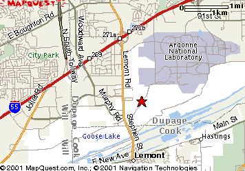
Take I-55 (Stevenson Expwy.) 21 miles southwest of the Loop. Take
exit 271A and go south on Lemont road 2 miles. Turn left (northeast)
on Bluff Road, just past the large white temple (you can't miss
it). Follow the orange and white orienteering signs through the
forest preserve gate.
Parking is restricted. You must park on the West (exit bound)
side of the gravel drive. Violators will be towed. If parking is
full you must find a legal parking place on the public roadways.
Since parking is limited, please carpool with other participants.
Public Transportation: Bring your bicycle for
this one--they are allowed on buses and el trains now. Take Pace
bus #381 from the 95th Street Terminal (in the middle of the Dan
Ryan Expressway) on the Red elevated line at 8:30am. Get off as
the bus at Moraine Valley Community College (about 40 minutes later).
Bike west on 95th Street about 3-1/2 miles to turn left on Archer
Avenue. Follow Archer (Hwy 171) southwest to turn right (north)
and cross bridge on Hwy 83—Kingery Expwy. On north side of
bridge, turn left on Bluff Road, and after a mile, continue through
gates into forest preserve. Ride paved/gravel roads of forest preserve
southwest and west to Registration, near the model airplane field,
in the southwest area of preserve. On the return buses depart every
30 minutes all afternoon from MVCC. It makes carpooling sound pretty
good, no? Links to public
transportation for other CAOC meet locations.
|